ADF STAFF
Confusion reigned for days after flash floods and landslides killed at least 91 people in the central Kenya town of Mai Mahiu in April. Police initially blamed a burst dam, but the government later said debris had blocked a railroad river tunnel.
“The water swept the railway line and started moving downstream with a very high speed and velocity causing destruction of property and loss of lives,” the Ministry of Water reported.
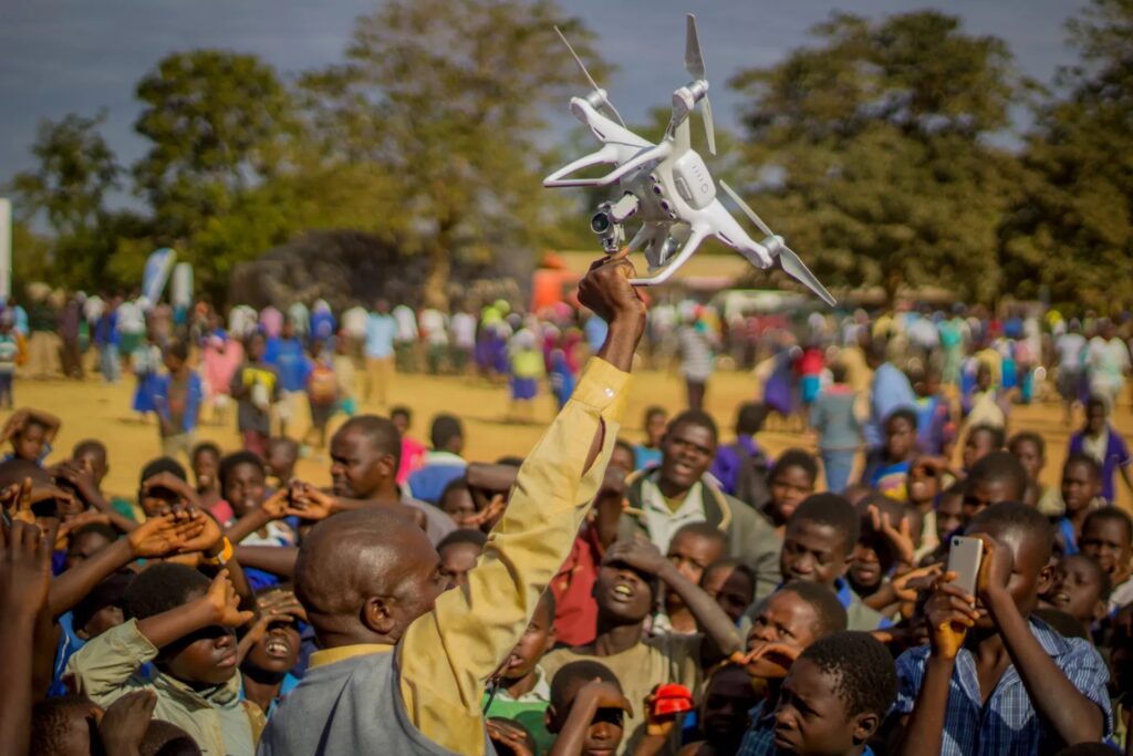
Antony Muchiri, emergency response manager at Kenya Red Cross, said unmanned aerial vehicles, or drones, played a key role in the country’s response to widespread flooding.
“We use drones extensively,” he told Kenyan newspaper The Standard. “We rushed and mapped the Mai Mahiu area following the dam incident. “This enabled us to advise the government through the Kenya Defense Forces incident commanders and alert the Rift Valley Academy and Kijabe Hospital just before another landslide happened. Mapping helped us to see areas of potential danger.”
As drones have become widely available on the continent, some countries are using them to prepare for and respond to natural disasters such as floods and droughts. Aerial photographs taken by drones helped the Red Cross identify roads that were cut off and survey buildings and homes that were damaged or destroyed. Some images showed foundations of buildings that were washed away by floods.
Muchiri said drone images enabled his organization to plan relief efforts in Garissa, getting critical supplies to victims by navigating washed-out roads or using air assets.
Before-and-after images showed changes in settlements such as the increase in temporary shelters at a Garissa camp. In Tana River County, drones documented whole villages swept away by floodwaters. Galili village turned into a temporary island only accessible by air.
Drone use also has expanded into search and rescue operations such as locating survivors and people trapped by natural disasters. Drones with thermal cameras can detect the body heat of buried landslide victims.
In July, rescuers used drones to help find victims of mudslides that killed at least 257 people in the Kencho-Shacha locality of the Gofa Zone, an isolated area of southern Ethiopia.
“The search for survivors is ongoing and is currently being supported by drones operated by experts from the Information Network Security Administration,” Firaol Bekele, early warning director at the Ethiopian Disaster Risk Management Commission, told Agence France-Presse.
In Malawi, officials used drones to assess damage to crops and buildings, and to determine the type of emergency response required after Cyclone Freddy in 2023 and flash floods in the districts of Karonga and Nkhotakota in 2024.
Between 2019 and 2021, The Gambia partnered with the United Nations to establish a state-of-the-art, end-to-end early warning system for flooding in the Gambia river basin. Relying heavily on drones, the system now uses artificial intelligence to quickly provide Gambian authorities with highly accurate mapping data.
Kenneth Kasera, a geographical information systems expert at the Regional Centre for Mapping of Resources for Development in Nairobi, Kenya, said drones have brought major advances to his work and can access virtually all locations.
“The processes have remained the same but how we do things has changed,” he told The Standard. “We placed cameras on birds to fly around with, then we downloaded the images recorded, back in the seventies. We moved to aircraft, then satellites, and we are now into the automation of things through machine learning and artificial intelligence. It’s been an interesting journey.”

